HGCP15
Hoodman 5-pack Ground Control Point kits drone aerial surveying photogrammetry tools
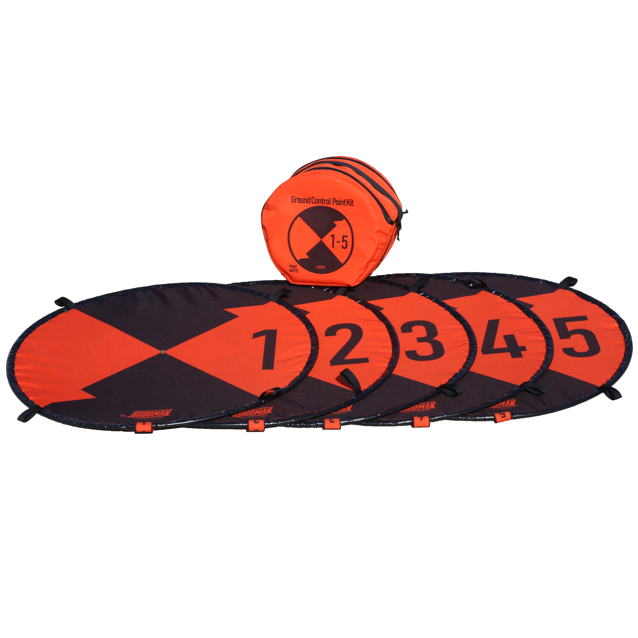
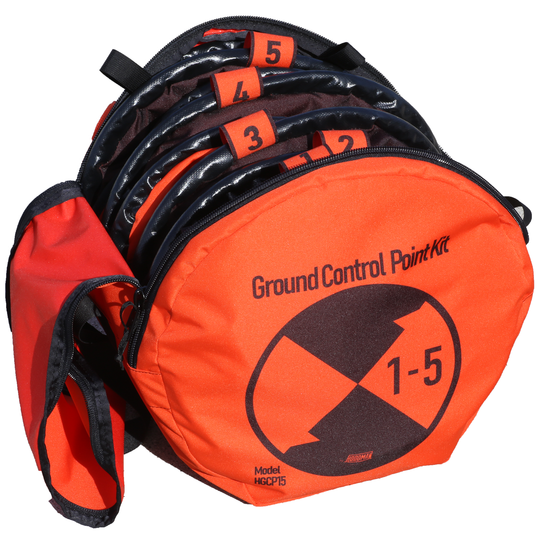
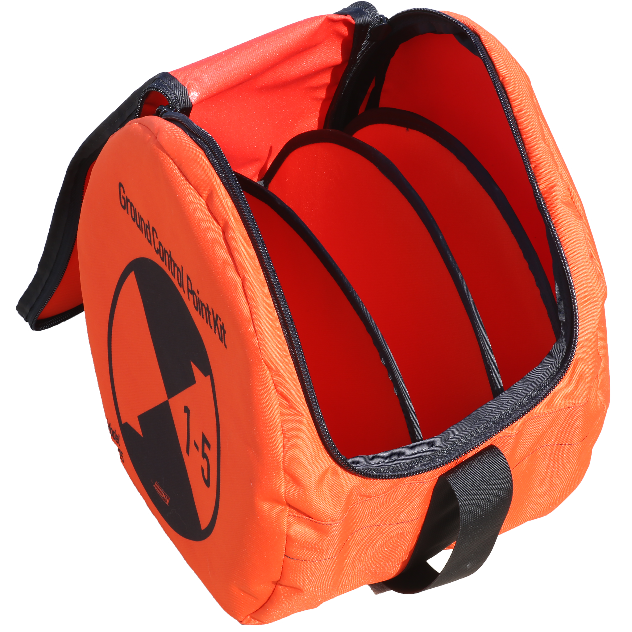
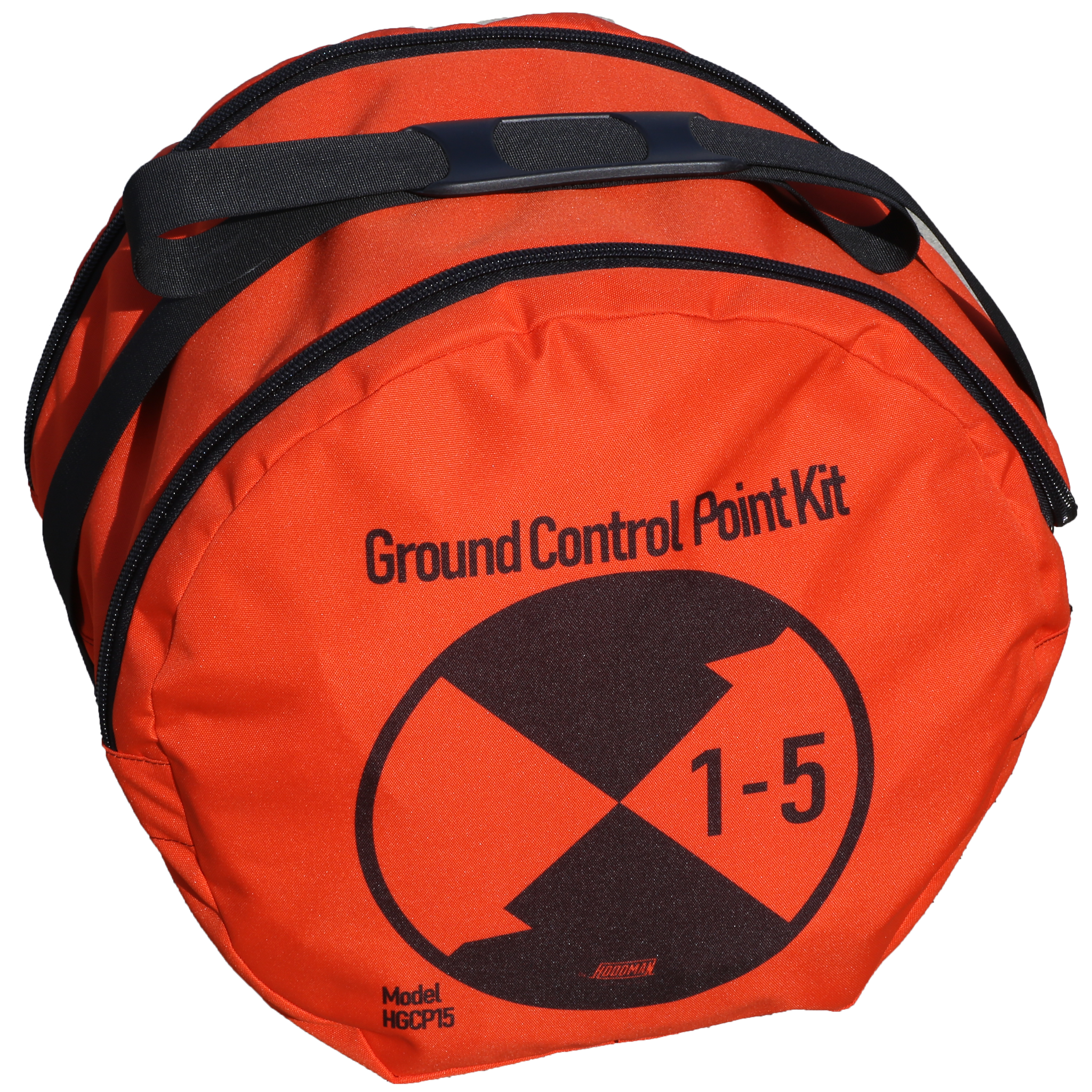
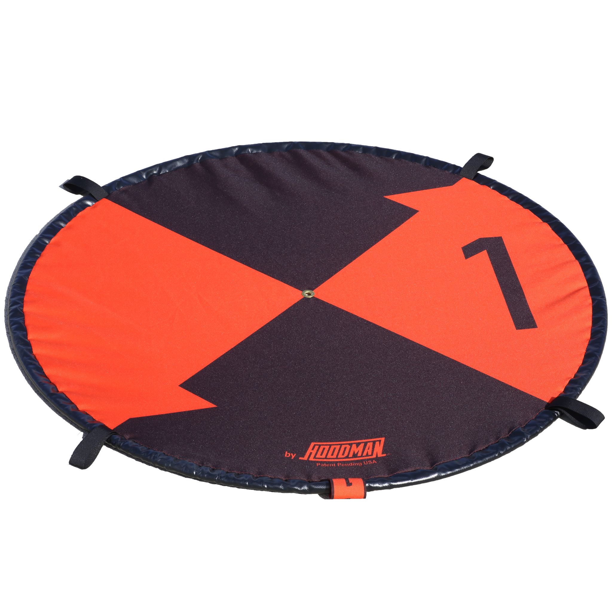
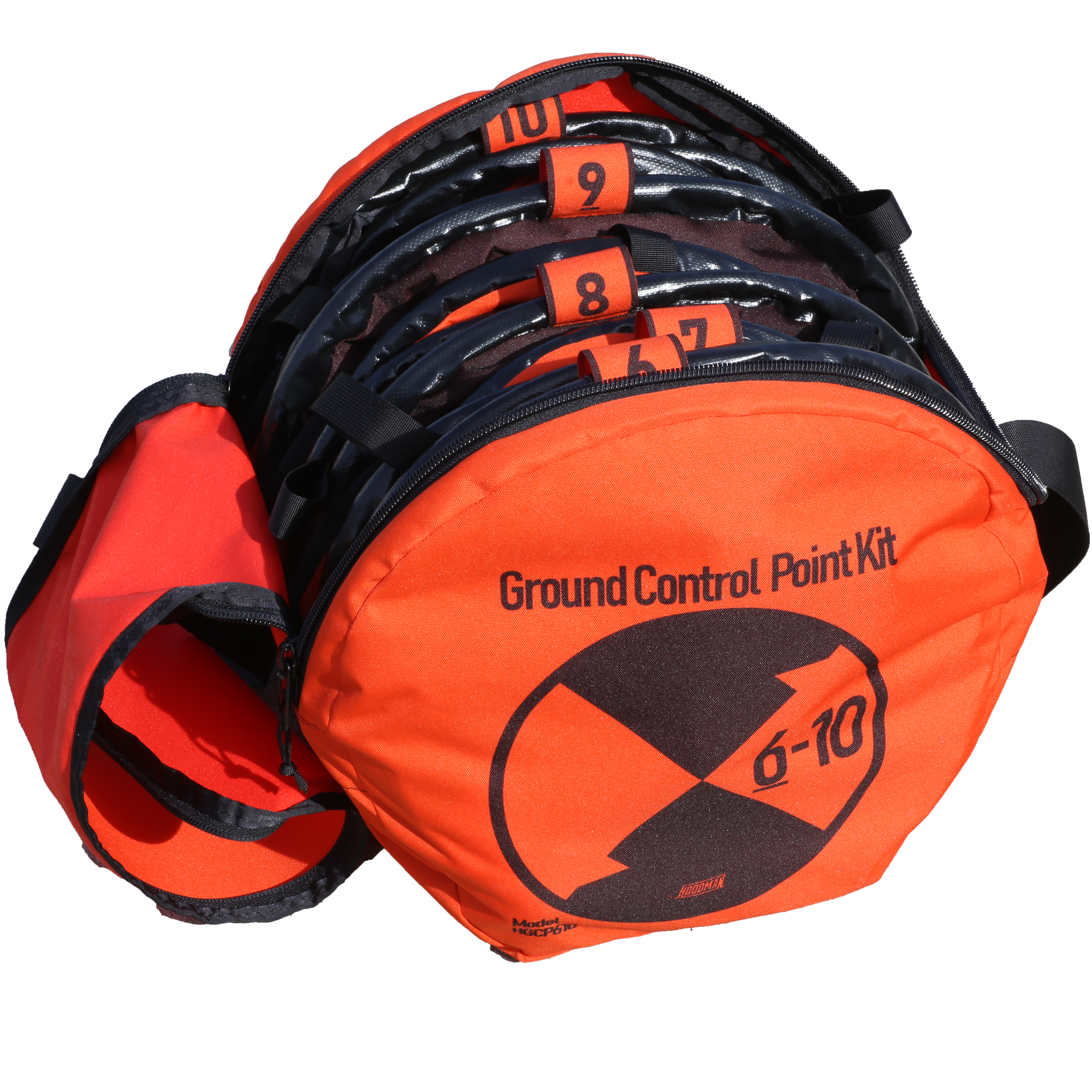
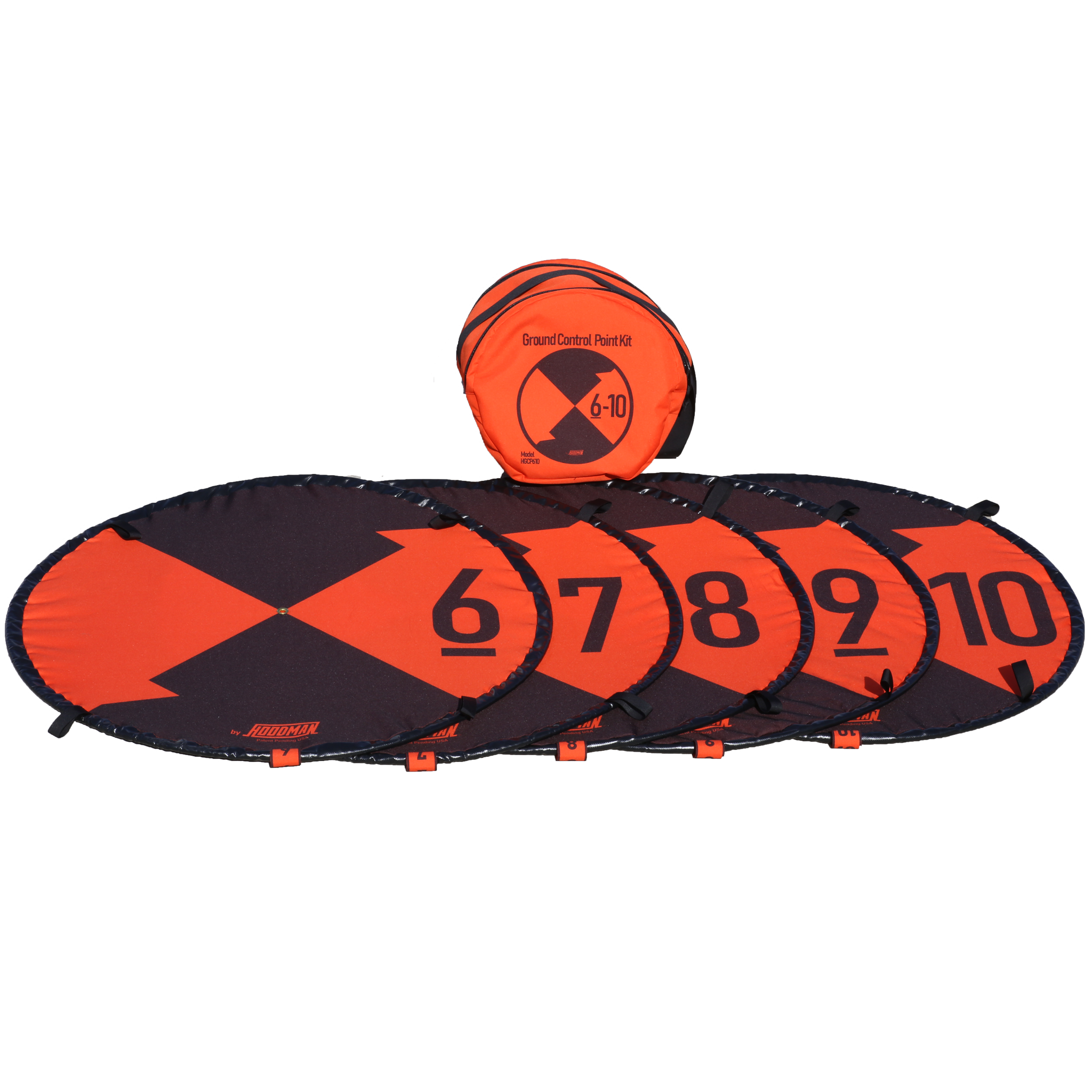
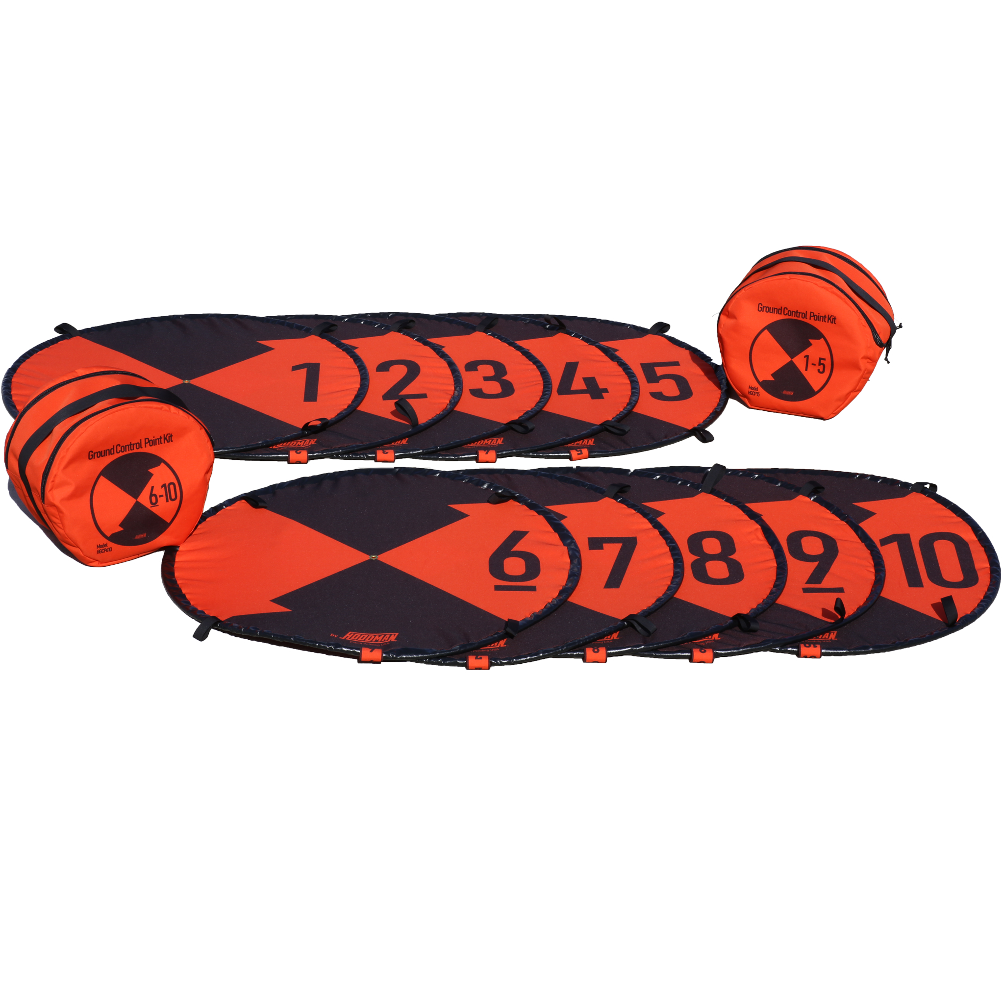
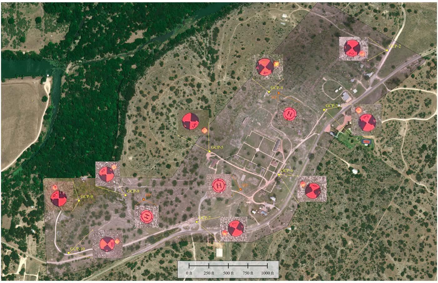
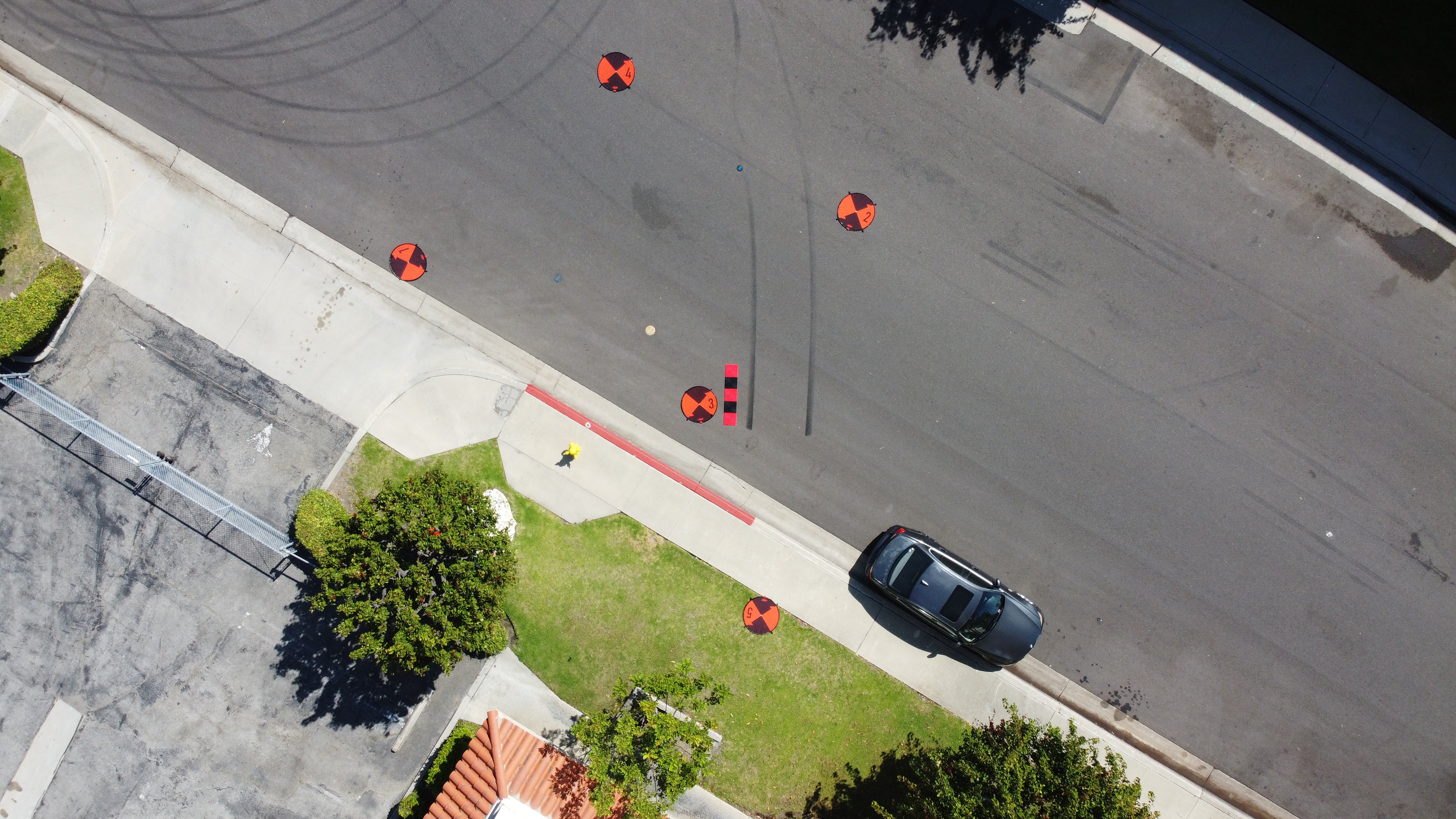
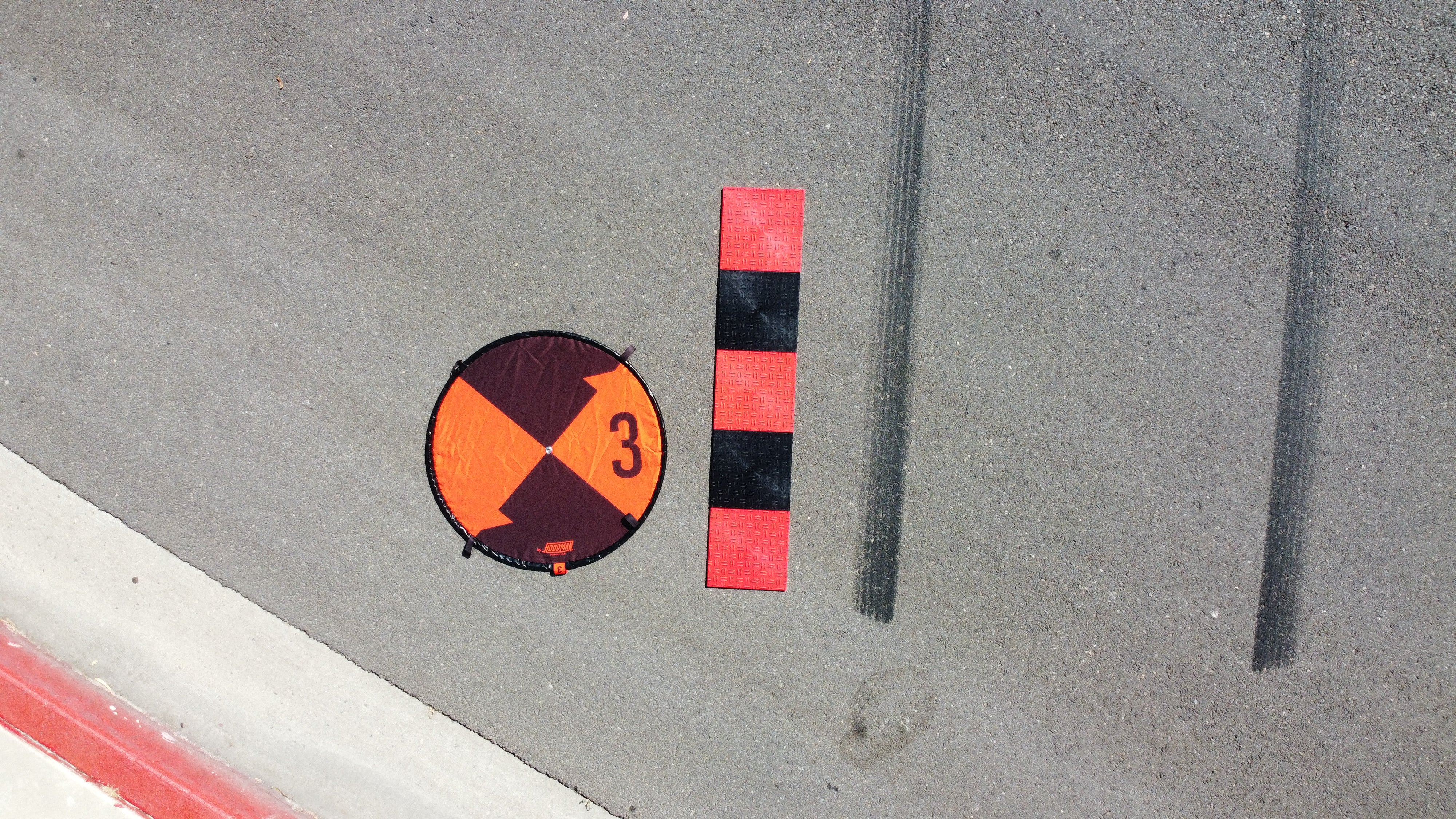
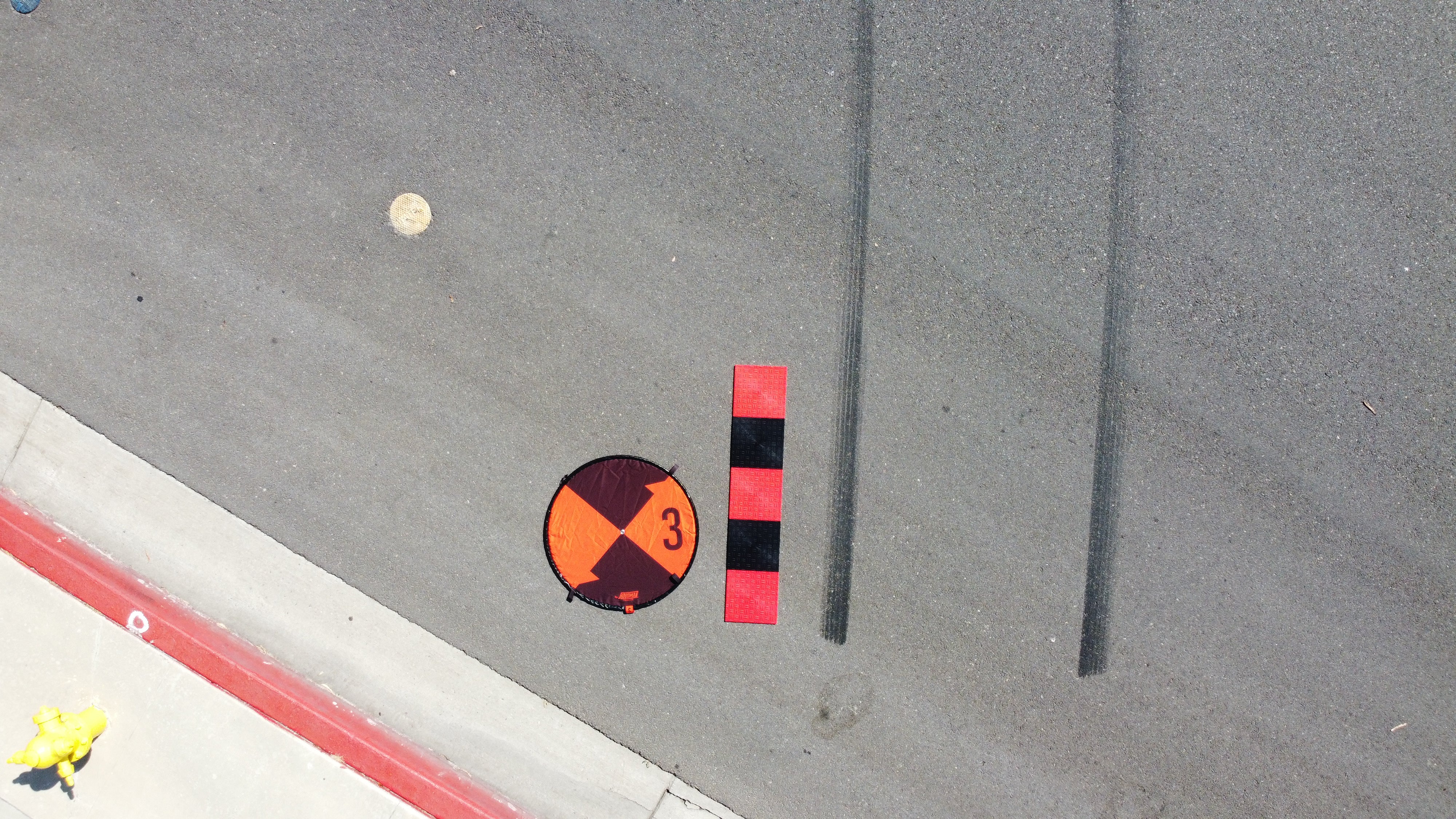
Hoodman Ground Control Point (GCP) Kits are made up of (5) 3Ft diameter, spring into shape, self-weighted circular pads that are numbered individually 1 – 5, or 6-10. The GCP Kit is made to last with galvanized steel perimeter cable and rugged polyester material. The weighted pad perimeter holds position with no need to pound in stakes. 4-tie down loops are included for long term GCP positioning where livestock might move the pads. Convenient 24 inch scaling constraint marks are printed into the pattern of each GCP. Each pad has a center grommet for surveyor staff placement for pinpoint accuracy of GPS coordinates. All 5 GCP pads weigh just 22 pounds total and fit snuggly in a convenient carry bag with shoulder strap. Cleanup is easy with mild soap and water. Be sure to let pads dry prior to placing in the carry bag to avoid mildew forming.
Click here for CUSTOM Drone Landing Pads
Couldn't load pickup availability
Pickup available at Hoodman Corporation
Usually ready in 4 hoursPairs well with
Hoodman 5-pack Ground Control Point kits drone aerial surveying photogrammetry tools
If you have any questions, you are always welcome to contact us. We'll get back to you as soon as possible, within 24 hours on weekdays.
-
Shipping Information
Use this text to answer questions in as much detail as possible for your customers.
-
Customer Support
Use this text to answer questions in as much detail as possible for your customers.
-
FAQ’s
Use this text to answer questions in as much detail as possible for your customers.
-
Contact Us
Use this text to answer questions in as much detail as possible for your customers.
Product details
Included in the box
- Ground Control Points
- Carrying case
- Folding Instructions
How do I clean my ground control point?
Cleaning Made Easy: Just use some gentle soap and sponge.

Use of Ground Control Points (GCP)
The use of Ground Control Points in drone aerial surveying enhances the accuracy and reliability of the data collected, making it an invaluable tool across multiple industries (Construction, Agriculture, Environmental Monitoring, Mining and Real Estate). Drone operators play a vital role in executing these surveys, contributing to informed decision-making and efficient project management.